This track is part of Te Araroa Trail.
Walking options
This is a one way track but it can be walked as return trips to the summit from either end. The track can also be accessed at the Hakarimata summit (374 m) via the Hakarimata Summit Track.
Southern section: Hakarimata Rail Trail to summit view tower
Time: 2 hr
Distance: 3.5 km
Walk the Hakarimata Rail Trail to its end. From there, the track crosses a small stream on a long wooden bridge, and follow a stream up through attractive forest. Shortly after crossing a second bridge and leaving the stream, the track climbs steeply through mature forest with excellent examples of rimu, miro, matai, rewarewa, tanekaha and kohekohe. The track undulates through the forest until reaching the junction of the Hakarimata Summit Track. From the junction it is a short walk to the summit tower.
Head back the way you came, continue along the Hakarimata Walkway to Parker Road (you'll need to arrange transport), or take the Hakarimata Summit Track down to Brownlee Avenue. A 1.8 km walk from Brownlee Avenue along Waingaro Road will take you back to your start point.
Northern section: Parker Road to summit view tower
Time: 4.5 hr
Distance: 6 km
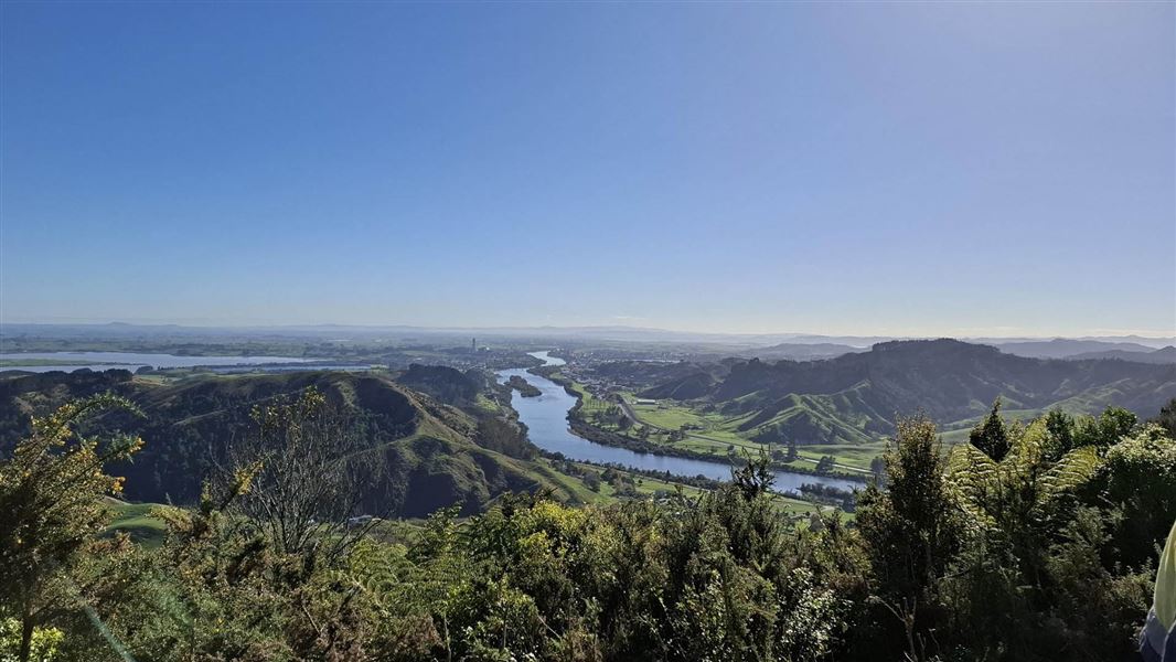
From the northern end at Parker Road, follow the Kauri Loop Track as far as the top viewing point, then take the track to the Southern Lookout where there are excellent views south across to Hamilton city. The track is undulating with exposed tree roots in places and rough underfoot. It passes through mature native forest of rimu, miro, matai, totara, rata, rewarewa, hangehange and tawa, with occasional views out to the west.
Head back the way you came, continue along the Hakarimata Walkway then walk the Hakarimata Rail Trail to Waingaro Road (another 2 hours 30 minutes), or take the Hakarimata Summit Track down to Brownlee Avenue (1 hour). You'll need to arrange from the end.
This section of the walkway is part of Te Araroa - New Zealand's Trail.
The northern section starts from Parker Road, off Hakarimata Road, approx. 7 km south of Huntly and approx. 11 north of Ngāruawāhia.
The southern section starts from Waingaro Road, off Hakarimata Road, approx. 3 km south of Ngāruawāhia.
The track can also be accessed via the Hakarimata Summit Track. This track starts on Brownlee Avenue, off Hakarimata Road, approx. 1 km north of Ngāruawāhia.
Stay safe in the outdoors
- Choose the right trip for you. Learn about the route and make sure you have the skills for it.
- Understand the weather. Check weather forecasts.
- Pack warm clothes and extra food. Check gear lists.
- Share your plans and take ways to get help. Leave your intentions with a trusted contact and take a distress beacon.
- Take care of yourself and each other.
DOC Customer Service Centre
| Phone: | 0800 275 362 |
| Email: | waikato@doc.govt.nz |
| Address: | Te Rapa Base |