
Water quality in Taputeranga Marine Reserve
Introduction
How good is the water quality in Taputeranga Marine Reserve and how is it changing?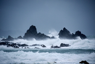
Island Bay during a storm
Image: Michelle | Creative Commons
Several powerful currents converge on Taputeranga Marine Reserve and the area frequently experiences strong waves from Cook Strait. It is a wild and dynamic environment.
Status: fair
Greater Wellington Regional Council’s recreational water quality monitoring programme rates its three sampling sites in Island Bay and one in Ōwhiro Bay as ‘B or C: moderate to low risk of illness’ for swimming and other recreational activities. The site in Princess Bay (on the eastern side of Houghton Bay) has an A grade or ‘very good, very low risk of illness’.
Island Bay has a large catchment, so a large amount of stormwater and wastewater enters the relatively small, partially sheltered bay, during and after heavy rain. Ōwhiro Stream drains several landfills (Wellington Southern Landfill and construction and demolition waste landfills T&T and C&D) and polluted water from these sites and the old Houghton Bay landfill site is carried into the marine reserve.
Enterococci bacteria
The recreational water quality monitoring results above are based on the number of Enterococci bacteria per 100 mL of water in all routine water samples from the past three summers. The results are generally below the ‘alert’ limit for Enterococci, but can reach ‘action’ levels after periods of heavy rain.
Enterococci bacteria have been traced to wildfowl and dogs as well as discharges of untreated human sewage in the catchment. Wellington City Council is working to improve the sewer in areas where ‘poor’ ratings are recorded.
Metal and organic pollutants
In 2014, levels of metals (cadmium, lead and mercury) in samples of pāua from Island Bay were below national food standards. The pāua also had very low concentrations of organic contaminants (polycyclic aromatic hydrocarbons, polychlorinated biphenyls and DDT).
Samples of sediment from the beach at Houghton Bay in 2012, where the stream crosses the beach, did not show any serious contamination with metals (except iron) or with polycyclic aromatic hydrocarbons.
View the recreational water quality monitoring map.
Trend: stable
The water quality at monitoring sites in the marine reserve has not changed significantly in the last 5 years. The shutdown of a short sewage outfall at Ōwhiro Bay in 1994, the closure of the Moa Point raw sewage outfall and the closure of the Ōwhiro Bay quarry in 2000 previously contributed to an improvement in the quality of water entering the marine reserve.
Note: The Moa Point Treatment Plant discharges a mixture of fully and partially treated sewage approximately 1.8 km from shore (and about 2 km from the eastern boundary of the marine reserve) during heavy rainfall events, which occur a few times a year.
View heavy rainfall discharges by year.
Monitoring
Greater Wellington Regional Council carries out weekly recreational water quality monitoring at Island, Ōwhiro and Princess Bays from the start of December until the end of March each year. The council carries out fortnightly monitoring for Enterococci at the Island Bay surf club site for the rest of the year.
View the monitoring data.
Read more about the monitoring programme.
Reports
- View Greater Wellington Regional Council’s annual data reports.
- T&T landfill discharge to the Ōwhiro Stream: Assessment of effects on freshwater quality and ecology. Aquanet Consulting Ltd 2017.
- Ōwhiro Stream and its catchment. Summary of existing water quality and freshwater ecology information, recommendations for future monitoring. Aquanet Consulting Ltd 2017.
- Wellington Water Ltd: Stage one global stormwater discharge consent. Resource consent application and assessment of environmental effects. Prepared by GHD for Wellington Water Ltd 2017.
- Stormwater discharge consent annual report: Resource consents WGN090219 [27418], [27419], [30500] & [30501]. Capacity Infrastructure Services Ltd. Unpublished report prepared for Wellington City Council 2012.
- Stormwater contaminants in the urban streams in the Wellington region. Milne and Watts 2008.