
Surrounding land at Taputeranga Marine Reserve
Introduction
How much is human activity on surrounding land affecting the health of the ecosystem at Taputeranga Marine Reserve and how is it changing?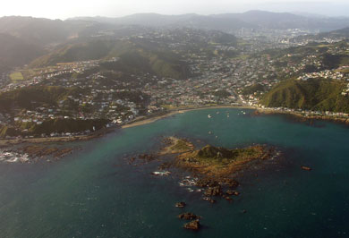
Island Bay and Taputeranga Island
Image: Phillip Capper | Creative Commons
The land surrounding Taputeranga Marine Reserve runs from Princess Bay in the east to Te Kopahou Visitor Centre in the west, and includes the seaside suburbs of Island, Ōwhiro and Houghton Bays.
As mapped below, its catchment (including extended areas to east and west) is approximately 50% urban land (roads and housing) and 50% forest, grassland and scrub.
Status: fair
Trend: stable
Island, Ōwhiro and Houghton Bays are well-established suburbs, surrounded by areas of rural land and bush reserve. Wellington city’s main landfill (Southern Landfill) is situated in Happy Valley, to the north of the marine reserve.
From 1951 to 1971, the city’s landfill was located in Houghton Bay, but this area is now used as playing fields. Stormwater runoff still contains contaminants from the site, but a 2012 investigation found that the effects of the discharge on the environment were minor.
Some of the habitats and species within the marine reserve are sensitive to human activities on surrounding land. These activities include urban development where sediment runoff occurs after heavy rain and rubbish blown from the landfill or carried down drains and streams to the sea.
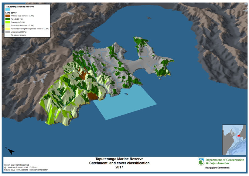
Taputeranga Marine Reserve catchment land cover classification 2017 View larger (JPG, 921K)
This map shows the land use of the catchment area of the marine reserve. It was mapped using remote sensing software from Landsat satellite imagery and verified with aerial imagery. The land use classes were a simplified version of the classes used in the Land Cover Database developed by Landcare Research.
Reports
- Houghton Bay leachate Wellington Water website