Marine Monitoring and Reporting Framework
Introduction
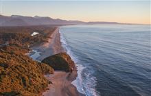
The Framework is focused on long-term monitoring of our marine environment through marine reserves.The Marine Monitoring and Reporting Framework (MMRF) is a national marine monitoring system. Building on past knowledge, it uses an innovative and flexible design. It can be adapted to meet the needs of the marine reserves and both local and national stakeholders.
The framework provides guidance for implementing long-term marine monitoring. It uses examples of best practice from around the world to guide how monitoring plans are developed for marine reserves. It does not develop new approaches but draws on existing knowledge and data.
A tool to monitor whole ecosystems
Many new and evolving threats face our ocean. The MMRF helps to offer key insights into marine environments, such as how protection affects their biodiversity. Through this, we can find out if marine reserves are meeting their objectives.
For many years, most monitoring was done on populations of species that are fished, such as tāmure/snapper. This was the main way we evaluated if a reserve was protecting them. This data is still important but does not reveal all the factors that might be affecting them or their environment.
By monitoring whole ecosystems using the MMRF, we can see more of what’s there, assess what condition it is in, and how it is changing. We can then record progress and find the best ways to use our resources for conservation.
Read the framework (PDF, 6,811K)
What will be monitored
The monitoring framework is built around 10 themes, each with their own specific objectives. The themes monitored at place depend on the local environment and the aspirations of mana whenua and local communities.
- Habitat representation – to determine if a range of marine ecosystems are protected nationally.
- Habitat composition and condition – to determine if habitats in protected areas change with time.
- Climate change – to track climate change indicators, such as ocean acidity and sea surface temperature.
- Key species – to determine how the populations of key or taonga (treasured) species, such as crayfish/kourā, change over time.
- Compliance – to understand how many people are following the rules in marine reserves.
- Water quality – to understand if water quality, such as clarity and pollutants, has improved in reserves.
- Human uses – to determine how much people are using reserves, such as for recreation or study.
- Non-indigenous species (invasive species) – to determine if invasive species are increasing or decreasing or showing up in areas they were not found previously.
- Extreme events – to understand how extreme events, such as floods or oil spills, may affect marine ecosystems.
- Marine pollution – to assess the impact of beach litter on marine reserves.
Marine rangers implement the work
To support the framework, DOC established a network of 13 rangers to cover 25 mainland marine reserves. These roles are a mixture of scientific monitoring, compliance patrols, and working with local communities to engage them with their marine reserves.
Regions and their included reserves:
- Auckland: Tāwharanui, Cape Rodney-Okakari Point, Te Matuku, Motu Manawa and Long Bay-Okura marine reserves
- New Plymouth/Taranaki: Tapuae and Parininihi marine reserves
- Wellington/Kāpiti: Kāpiti and Taputeranga marine reserves
- Nelson/Tasman: Tonga Island, Hohoirangi, and Long Island marine reserves
- Banks Peninsula and Christchurch: Akaroa and Pohatu marine reserves
- Whangarei: Whangarei Harbour and Poor Knights Islands marine reserves
- Whitianga: Cathedral Cove/ Whanganui A Hei marine reserve
- Napier and Gisborne: Te Angiangi and Te Tapuwae o Rongokako marine reserves
- Kaikōura: Hikurangi marine reserve
- West Coast: Punakaiki, Hautai, Kahurangi, Waiau Glacier and Tauparikaka marine reserves
Learn more about individual Marine reserves.
Working with others
Mātauranga (Māori knowledge) is woven throughout the monitoring plans. We do this by asking whānau, hapū and iwi how and what they want to monitor at place. This is unique for every whānau, hapū and iwi who connect to the marine reserve and ranges from rangatiratanga — managing and implementing the monitoring plans themselves — to staying informed about the monitoring and results.
Observations from both mātauranga and monitoring are used when making management decisions.
Partners of the marine monitoring framework include:
The New Zealand Ocean Acidification Observing Network (NZOA-ON)
The NZOA-ON is a programme jointly run by NIWA and the University of Otago. The partners have been monitoring ocean acidity in Otago since 1998. The network aims to establish coastal sites around the country to collect monthly measurements at a range of urban and remote locations, to identify any effects that the local environment may have on ocean pH.
DOC has committed to take over ocean acidity sampling for several sites, conducted alongside monthly standard monitoring. Ocean acidity will be monitored regularly at reserves across the country.
Litter intelligence by Sustainable Coastlines
The most thorough marine litter monitoring programme in New Zealand is Litter Intelligence. It is run by the charity Sustainable Coastlines. A long-term beach-cast litter monitoring programme, it aims to provide full coverage of all mainland regions. The methods used to monitor beach-cast litter were co-developed with DOC.
iNaturalist
iNaturalist is a citizen science platform that allows users to upload and name organisms that they find. Photos are automatically tagged with the date and location and the site offers suggestions for what species is the focus of the photograph. The Marine Monitoring and Reporting Framework draws on this platform and its users to create species lists for marine reserves and to track the spread of invasive species. We are encouraging people connected to marine reserves to take and upload photos.
Wildlife.ai and Zooniverse
DOC is working with Wildlife.ai to run the citizen science project Spyfish Aotearoa. This project classifies fish species from underwater footage recorded in marine reserves around the country.
By analysing 10-second video clips and the photos of fish, volunteers help to process the footage. They provide information for marine scientists to find out how effective the reserves are. This helps to protect taonga (treasured) species. Citizen scientists can help by joining the Spyfish Aotearoa project on Zooniverse.