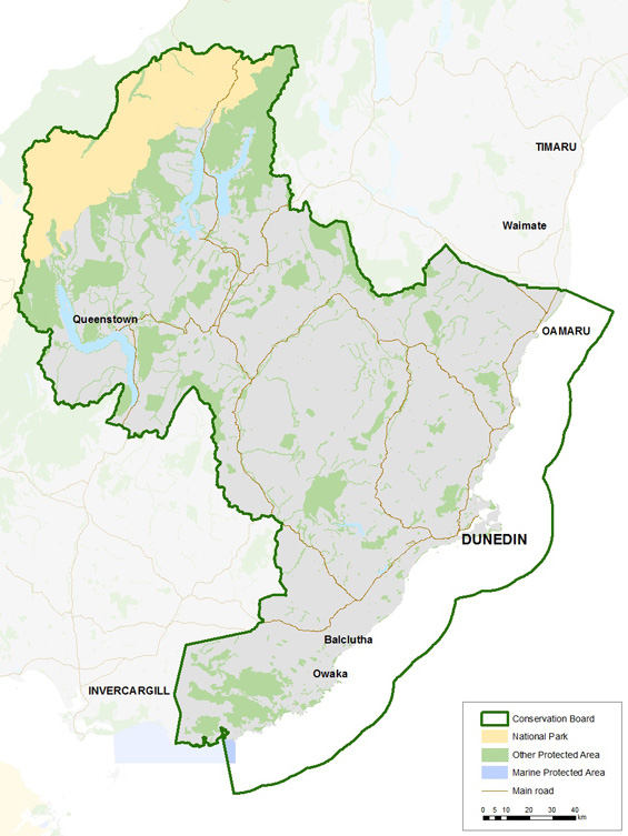
Otago Conservation Board district
Introduction
Each Conservation Board operates in a geographical jurisdiction determined by the Minister of Conservation. Find out about the Otago Conservation Board district.The board's district runs from the eastern coastline, across dry inland valleys, and over the Southern Alps to the west covering an area of 2,793,630 hactares. The variation in landscape provides a wide range of ecosystems with a range of species which are found only on private land.
Significant areas
Mount Aspiring National Park is New Zealand’s third largest national park; it is home to 59 bird species and over 400 species of moth and butterfly. This vast area has been formed through glacial activity with a divide between the wetter western side and the drier eastern side creating a distinction in flora.
The Catlins Coastal Rainforest Park is the collective name for the Conservation Park that sits inland and the various conservation areas along the coast. Inland is home to several rare birds, such as yellowheads (mohua), whilst the coastline is famously a refuge for all four seal species found in New Zealand - elephant seals, leopard seals, sealions/pakake, and fur seals/kekeno.
The Remarkables is an extremely steep, rugged mountain range that extends to 2,234 metres and boasts a number of beautiful features, such as Lake Alta, a small lake nestled within a natural amphitheatre at the head of a glacial valley and below the towering Double Cone peaks. Parts of the public conservation land at these sites are occupied by commercial ski fields that are well- known for winter recreational activities.

You can view a more detailed map of the Otago Conservation Board district (PDF, 966K) This detailed map shows conservation areas and reserves and Department of Conservation offices.
