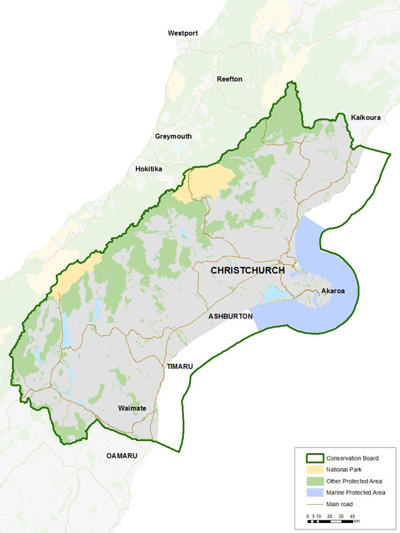
Canterbury Aoraki Conservation Board district
Introduction
Each Conservation Board operates in a geographical jurisdiction determined by the Minister of Conservation. Find out about the Canterbury Aoraki Conservation Board district.The Canterbury Aoraki Conservation Boards’ area of jurisdiction extends from the Conway and Clarence rivers in the north, and west to the main divide, including all of the Arthur’s Pass National Park. The southern boundary is the catchment of the Waitaki River at Kurow, along the river to the east coast. The coastal boundary is the twelve-mile limit for marine reserves and the Exclusive Economic Zone for marine mammals.
Significant areas
Aoraki/Mount Cook National Park has 19 peaks stretching 3,000 metres, and includes Aotearoa’s highest mountain, Aoraki/Mount Cook. This alpine terrain is host to over 300 species of plants, and 40 species of birds, including kea.
Arthur’s Pass National Park supports striking contrast in habitats on either side of this Mountainous range. The two distinct rainforest and alpine environments support a range of wildlife and native flora.
The Boards’ district also includes Pōhatu Marine Reserve, Akaroa Marine Reserve, and Horomaka/Banks Peninsula Marine Mammal Sanctuary. These marine protected areas provide protection for marine ecosystems and mammals, including supporting a healthy habitat for the hector’s dolphin.
Te Waihora/Lake Ellesmere is Canterbury’s largest coastal lake. This area, jointly managed with Ngāi Tahu, is internationally important to wildlife and wetland conservation.

