Mica Mine Tops Route
Located in Haast, Paringa and Moeraki rivers area in the West Coast region
|
Introduction
The Mica Mine Tops Route is a challenging route within the rugged backcountry environment of South Westland.Seasonal restrictions
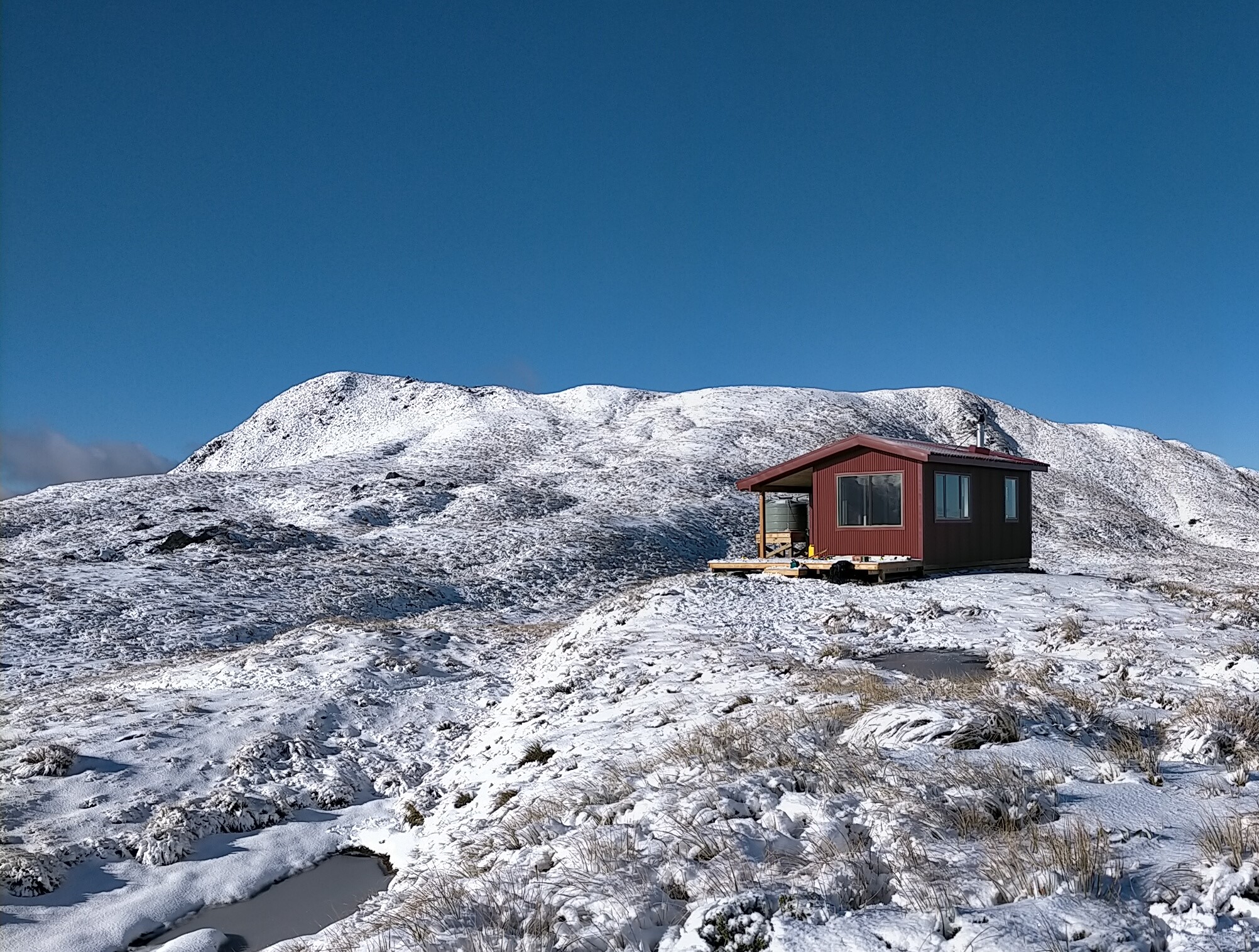
In winter, snow may affect access to, and along, the tops to the hut.
The tracks are located in a popular Haast Roar hunting area, so may be particularly busy throughout the Roar period (mid-March to mid-April).
Dog access
Mica Mine Tops Route is started from the Historic Haast to Paringa Cattle Track.
The turn off to Mica Mine Tops Route is signposted around 2 hours after Blowfly Hut on the Historic Haast to Paringa Cattle Track.
Turn off after Blowfly Hut to Mataketake Hut
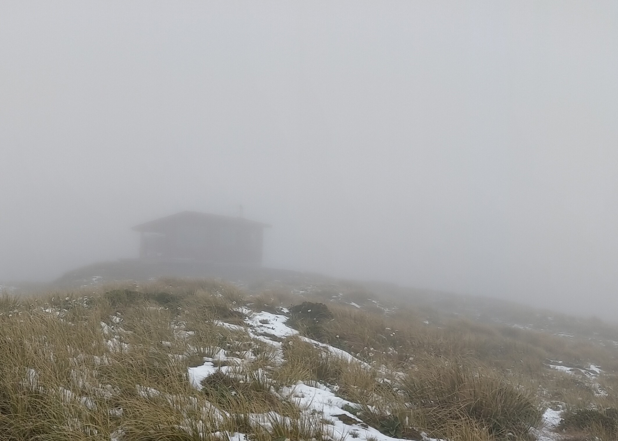
Travel along the Mataketake Tops Route should only be attempted in clear weather – above the bush line, cloud can obscure the route making navigation difficult. If you’re unsure about the conditions you should wait for better weather.
Only those with backcountry route finding/navigation skills, safety equipment including personal locator beacon (PLB) and warm, weatherproof clothing should attempt this route.
The Mica Mine Tops Route leaves the main Cattle Track and zig zags through 23 corners up to 960 m high. At this point, the original track benching has been lost due to slips and treefall. You’ll need to follow a marked route the rest of the way up a scrubby, rocky spur to the bushline.
Once you’re on the open tops, the route is poled and meanders southwest along the Mataketake Range, passing between tarns and rock fields. On a clear day, there are excellent views from mountains to sea as the route follows the dips and hollows of the range to Mataketake Hut.
Mataketake Hut can be reached via Māori Saddle Route and Mica Mine Route. We recommend going up to the hut via the Māori Saddle Route. This will give you the best opportunity to judge the weather conditions on the tops and enable easy retreat if needed.
Mica Mine Tops Route is started from the Historic Haast to Paringa Cattle Track.
The turn off to Mica Mine Tops Route is signposted around 2 hours after Blowfly Hut on the Historic Haast to Paringa Cattle Track.
What to expect
- A challenging backcountry tramp, with a rough unformed track and marker poles
- Exposure to weather while on the tops – it’s common to experience high wind, rain/snow, freezing temperatures and low visibility
- Unbridged stream crossings on the lower sections of the Haast to Paringa Cattle Track
- In winter, snow may prevent you getting onto the tops or to Mataketake Hut
- People hunting during the roar (mid-March to mid-April)

Mataketake Hut in snow
Image: Cameron Bollard, DOC use only

Mataketake Hut in cloud
Image: Cameron Bollard, DOC use only
What you need
To enjoy this challenging but rewarding route, you should:
- be comfortable walking 8 hours in a day through rough terrain
- be experienced in backcountry alpine tramping, including in untracked areas and in bad weather – you need to be able to judge when the conditions are safe to proceed and when to wait at a hut, camp where you are, or turn back
- have good navigation skills, e.g. able to use GPS or a map and compass
- have good river crossing skills
How to plan and prepare
Streams on the Haast to Paringa Cattle Track flood quickly when raining. We recommend waiting for water levels to drop before crossing. How to cross a river safely.
Contact the DOC Visitor Centre at Haast to get a current weather report before starting your trip. Weather on the tops can be extreme. Assess the weather as you reach the tops, and turn back if you aren’t equipped for the conditions.
Times given are a guide only and will vary greatly with fitness and weather. Tramping in this area is demanding, so allow plenty of extra time.
Packing for this trip
- This is a remote tramp and you will need to be self-sufficient. Make sure to pack a distress beacon, emergency shelter, and extra food.
- Pack plenty of warm and waterproof clothing, so you can stay warm and dry on the tops.
Movement along the Alpine Fault has caused the uplift of the Mataketake Range, creating a fascinating landscape both above and below the bush line. At lower altitudes the routes pass through an attractive mix of rimu, beech and hardwood species, before climbing up onto the tops with rock fields, tussock and views across the Southern Alps Ka Tiritiri o te Moana and the Tasman Sea.
The Moeraki/Mataketake area has abundant wildlife and intact ecosystems thanks to an ongoing programme of landscape scale 1080 operations to control introduced pests – possums, rats and stoats. The native birdlife is outstanding and on this walk you will be treated to melodious calls from many native bird species. It is one of the few places where kākā are abundant and there have been reports of kiwi calls and mohua. Report any sightings/calls of kiwi or other less common native species.
Stay safe in the outdoors
- Choose the right trip for you. Learn about the route and make sure you have the skills for it.
- Understand the weather. Check weather forecasts.
- Pack warm clothes and extra food. Check gear lists.
- Share your plans and take ways to get help. Share directly or use the Outdoor Intentions form or Plan My Walk. Take a distress beacon.
- Take care of yourself and each other.
Contacts
| Awarua/Haast Visitor Centre | |
|---|---|
| Phone | +64 3 750 0809 |
| haastvc@doc.govt.nz | |
| Address | Haast Junction Corner SH6 and Jackson Bay Road Haast 7886 |
| Hours | Visitor centre hours and services |
