Navigation safety for Subantarctic and Kermadec Islands
Introduction
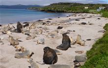
How navigation safety is managed for the Subantarctic and Kermadec Islands.The Subantarctic and Kermadec Islands lie between 200 km and 1,000 km offshore of mainland New Zealand.
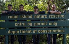
The islands and their coastal marine areas are subject to a range of protective measures under various legislation. Large parts of the territorial sea surrounding the islands are marine reserves. The islands themselves are nature reserves. In the Subantarctic Islands, the islands themselves are also national reserves and World Heritage Sites.
Environment Canterbury Harbourmaster's Office (ECan) manages navigation safety for the internal waters and territorial sea surrounding the Subantarctic and Kermadec Islands. ECan has been engaged by DOC to do this work.
Remoteness of the islands
A maritime accident could have a catastrophic effect. This is due to:
- the islands’ remoteness
- the endemic nature of their flora and fauna
- the threat status of many species.
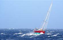
Any rescue or help required by vessels will likely be delayed due to their remoteness. It would place those involved at risk because of the extreme environmental conditions.
Vessels navigating the islands are generally designed for the purpose and the harsh environment. They need a high level of self-sufficiency, equipment and an extremely competent crew.
Safety management system
To help mitigate and manage the risk of a maritime accident, a safety management system has been developed. This is in line with the principles of the NZ Port and Harbour Safety Code (the Code) and ensures effective safety management to an agreed national standard.
The safety management system includes:
- risk assessments
- documented systems and procedures with regular review and assessments
- non-regulatory controls and guidance
- regulatory controls and requirements
- process for assessment of activities before they take place, eg the Harbourmaster’s Office assessment of planned cruise ships passages before the voyage
- provision of up-to-date information
- integration with existing operator systems to avoid additional work that does not improve safety.
DOC has committed to maintaining the standards set out within the Code. We will:
- audit the safety management system so it remains consistent with the Code
- report the audit and assessment results to the Director General each year.
The safety management system is modelled on ISO 9001:2015 and is audited to ensure consistency.
Controls and requirements
There are various controls and requirements that apply to any vessel visiting the islands. Some of these are for maritime safety purposes and some for environmental purposes. They all affect how a vessel is navigated and activities are carried out.
These controls and requirements include:
- how close a vessel may get to the islands
- the maximum size of vessels that may enter certain areas
- where a vessel may anchor
- speed of vessels
- interaction with marine mammals
- zodiac operations
Vessel operating guidelines are provided for each island group:
GPS application GPX files:
- Subantarctic Wildlife Protection Zones GPS - GPX file (GPX, 5K)
- Kermadec Island GPS - GPX file (GPX, 3K)
Maritime NZ has general information on vessel operation in New Zealand:
Contact
Contact the Harbourmaster’s Office as early as possible if planning a visit.


