For tide, boundaries and other information on the go, you can download the MarineMate app.
You must have a permit to land in these areas. Permission is only given to visits with a high justification. You must strictly adhere to the minimum impact code.
More information about visiting the subantarctic islands.
Location and boundaries
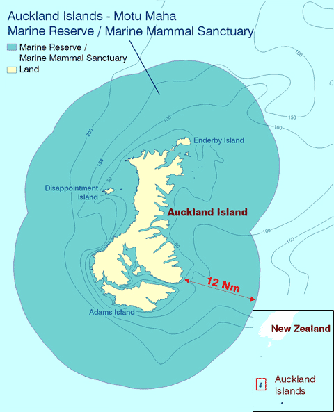
The Auckland Islands - Motu Maha Marine Reserve covers an area of about 484,000 ha in the Southern Ocean surrounding the Auckland Islands.

The reserve is located between latitude 50’ 16" south and 51’ 19" south and longitude 165’ 32" to 166’ 39" east, approximately 460 kilometres south of the South Island of New Zealand.
The reserve stretches for 12 nautical miles around the islands.
Downloadable map
Auckland Islands - Mōtū Maha Marine Reserve map (PDF, 639K
GPS information
Auckland Islands - Mōtū Maha Marine Reserve GPS file (GPX, 1K)
- 50° 33.806' S 166° 40.609' E
- 50° 44.674' S 166° 31.91' E
- 50° 53.501' S 166° 32.969' E
- 51° 7.634' S 166° 1.839' E
- 50° 48.566' S 165° 33.219' E
- 50° 38.573' S 165° 38.164' E
- 50° 29.258' S 165° 41.61' E
- 50° 17.242' S 166° 21.021' E