There is a conservation centre in Otehei Bay, 26 December to 6 February every year.
The conservation centre has historical info about the island, info about project island song, info about bottlenose dolphin’s in the Bay of Islands. It also serves as a base for children's’ activity days and a pop-up library.
Getting to Urupukapuka Island
Water taxis run on demand year round (weather permitting). The Paihia isite takes bookings for boat transportation to the island.
Passenger ferries go from Paihia and Russell to Otehei Bay every day in the peak summer season. See Explore's website for sailing times and to book.
Private boats can leave from boat ramps in the Eastern Bay of Islands:
- 30 minutes from Waitangi boat ramp on Te Karuwha Parade
- 15 minutes from Te Uenga Bay beach ramp on Russell Road
- 10 minutes from Kaimarama Bay boat ramp at the end of Rawhiti Road
- 45 minutes from Opito Bay and Doves Bay
To get to Urupukapuka Island you need to go through Te Pēwhairangi (Bay of Islands) Marine Mammal Sanctuary. Before you go check the restrictions for this marine mammal sanctuary.
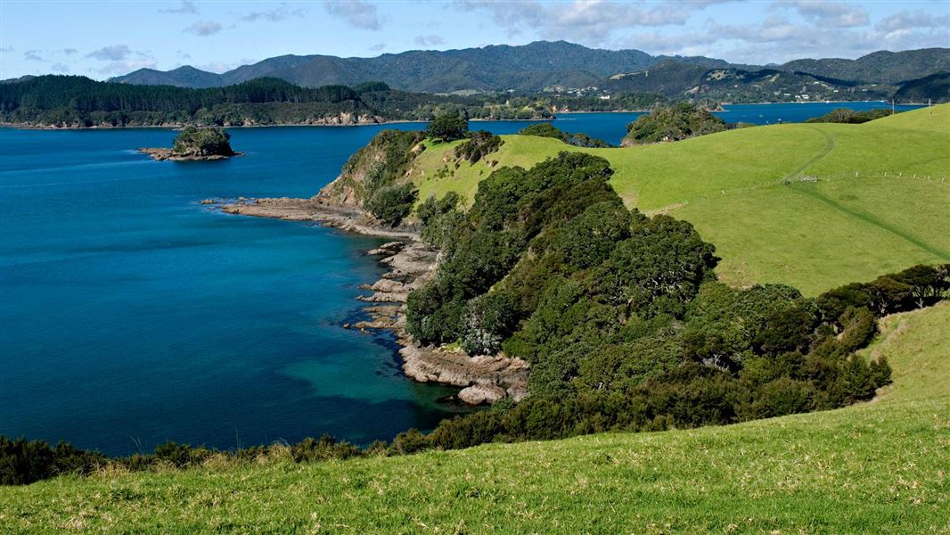
Topography
The island’s topography is the most varied of the islands in Ipipiri and ranges from flat areas behind the major bays (Entico, Otehei, Urupukapuka) and rises to moderately steep slopes and coastal cliffs on the island’s eastern side.
Vegetation
The main vegetation type is manuka/kanuka shrubland and extensive kikuyu grasslands are features of northern and southern areas of Urupukapuka. A spectacular pohutukawa forest occupies the coastal fringe and pohutukawa are a highlight of the island's vegetation. There is a significant wetland habitat created in the 1980s as a wildlife habitat with baumea sp. and raupo reed land.
Conservation
Urupukapuka has significant restoration potential with its range of habitats, natural regeneration and breeding area for brown teal/pāteke and NZ dotterel.
As part of the on-going restoration of Urupukapuka, Project Island Song has successfully released North Island robin/toutouwai, North Island saddleback/tīeke and whitehead/pōpokotea on the island. Keep an ear and eye open for these rare birds when visiting.
Grazing occurs on approximately a third of the island in order to maintain open space and vegetation on archaeological sites.
Read about the history and significance of Urupukapuka Island.
Check you are pest-free
Check, clean, and seal your gear to ensure you don't bring pests, soil, and seeds.
DOC Customer Service Centre
| Phone: | 0800 275 362 |
| Email: | bayofislands@doc.govt.nz |
| Address: | Pewhairangi / Bay of Islands Office |