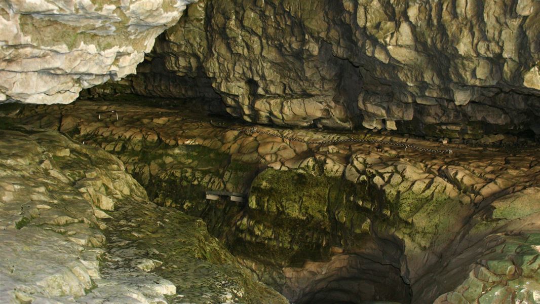
Cave Stream Scenic Reserve.
Caving at Cave Stream

Located in Cave Stream Scenic Reserve in the Canterbury region

This caving trip requires low river flows and no rain, as well as strong fitness, the right gear and confidence in outdoor activities.

People have died at Cave Stream – drowning and hypothermia are a real risk here. Read the information below and decide whether this trip is right for you.

Cave Stream Loop Walk offers a family-friendly alternative and is the recommended way to experience this place. It has lookouts with great views of the cave entrances.

Caving trip more difficult since 2022 floods

Floods in early 2022 scoured out the cave and have made the water in the cave deeper. It used to be around waist-high on an average adult in normal water flows, but it is now chest-high in the same conditions.

This has made the trip more difficult. We do not recommend this as a trip for children.

If you wish to proceed with the trip, read the following information carefully.

Only proceed during low river flows and when no rain is forecast

The deepest section is usually at the first corner at the stream outlet/cave entrance (the start of this trip). Check the water level here. If it is higher than you expect, do not proceed.

Look out for other signs that that the cave is not safe to enter, as there is too much water:

  • The stream is high
  • Water is discoloured or foaming
  • Water is spilling across the limestone terrace beside the channel at the cave outlet, rather than fully contained within the channel
  • The sound of water in the cave is very loud
  • Broken River is difficult to cross to access the cave

cave-stream-low-flow-visable-390.jpg
Cave Stream with limestone terraces at the cave outlet visible - see larger version (JPG, 817K)
Image: Fyletto © 

390 float right.
Cave Stream with water covering the limestone terraces at the cave outlet - view a larger version (JPG, 298K)
Image: Fyletto ©


Heavy rain in the Craigieburn Range can cause flooding in the cave in around 30 minutes, which is less time than it takes to climb through the cave. Do not start the trip if rain is forecast or if you can see it is raining in the distance, even if the river levels are okay at that point – they could rise quickly.

Summer is the best season

The water is always very cold, but any snow on the nearby mountains means the water will be near freezing temperature. It is particularly cold during winter and spring (when the snow is melting).

Watch your party for signs of hypothermia.

You need the right skills and gear

This is not an easy trip: you need good fitness, the right gear, and confidence in outdoor activities. Think carefully about whether it is right for you.

On your way through the cave, you will encounter:

  • Chest-high water (under normal flow conditions, deeper if the stream levels are high)
  • Several 1-1.5 m waterfalls that you will need to climb up without any ladder or steps
  • A 3 m waterfall by the stream inlet/cave exit, which you will need to climb a ladder to get around
  • A narrow ledge above the 3 m waterfall, which you will need to scramble along
  • A rockfall pile that you will need to climb over
  • Strong currents that you will need to walk against

Be aware that the limestone in this area is unstable. Rocks may fall onto the track leading down to Broken River and in the cave itself.

You will need to wear/take:

  • Two reliable lights per person. Head torches are best as they leave your hands free. Store handheld torches and other items in a waterproof bag
  • Spare batteries for the lights
  • A wetsuit is best, or at least warm polypropylene or wool clothing. Do not wear cotton or denim, as this will make you very cold when it gets wet
  • Study footwear
  • High-energy snacks
  • Helmet
  • Warm hat and gloves

We strongly recommend that you do not attempt the trip alone and that you share your plans with a trusted contact, asking them to call for help if you do not return when expected.

Caving route

The cave passage meanders and twists in pitch darkness for 594 m between the two entrances. There is a 3 m waterfall at the inlet end.

Cavers are recommended to enter the cave at the stream outlet and walk against the flow of the stream. There are several small waterfalls to climb. To assist climbing out the stream inlet end of the cave, a rung ladder ascends beside the waterfall. A chain and steps help to get along the overhang ledge to the cave exit.

Scour holes, terraces and small waterfalls can be seen while going through the cave.

cave-stream.jpeg
Cave Stream - view a larger version (JPEG, 51K) | DOC

Cave Stream Reserve is on SH73, between the Broken River road bridge and Craigieburn Forest Park entrance, about 90 minutes drive from Christchurch. There is a car park and public toilets.

Carefully decide whether the trip is right for you

Read the description section carefully before deciding whether you want to attempt this trip. People have died in the Cave Stream cave, and drowning and hypothermia are real risks.

Be aware that even if you have gone through the cave in the past, it is likely to be more difficult now. Recent flooding has made the water deeper than it used to be.

We recommend enjoying the Cave Stream area on the Cave Stream Loop Walk, which has good views of the cave’s mouths and is suitable for all ages and fitness levels.

Private property on other side of the river and stream

The land on the opposite side of Broken River and Cave Stream is private property. It is part of Castle Hill Station and Flock Hill Station. Public access is only by prior arrangement and/or registration.

No camping and no fires allowed in the reserve

This includes no overnight camping in the car park, even in self-contained vehicles. Mistletoe Flats Campsite is nearby at Craigieburn Forest Park.