Dogs not permitted during the lambing and calving period - September to November.
Swingbridge to South Mavora Lake
Time: 2 hr 30 min
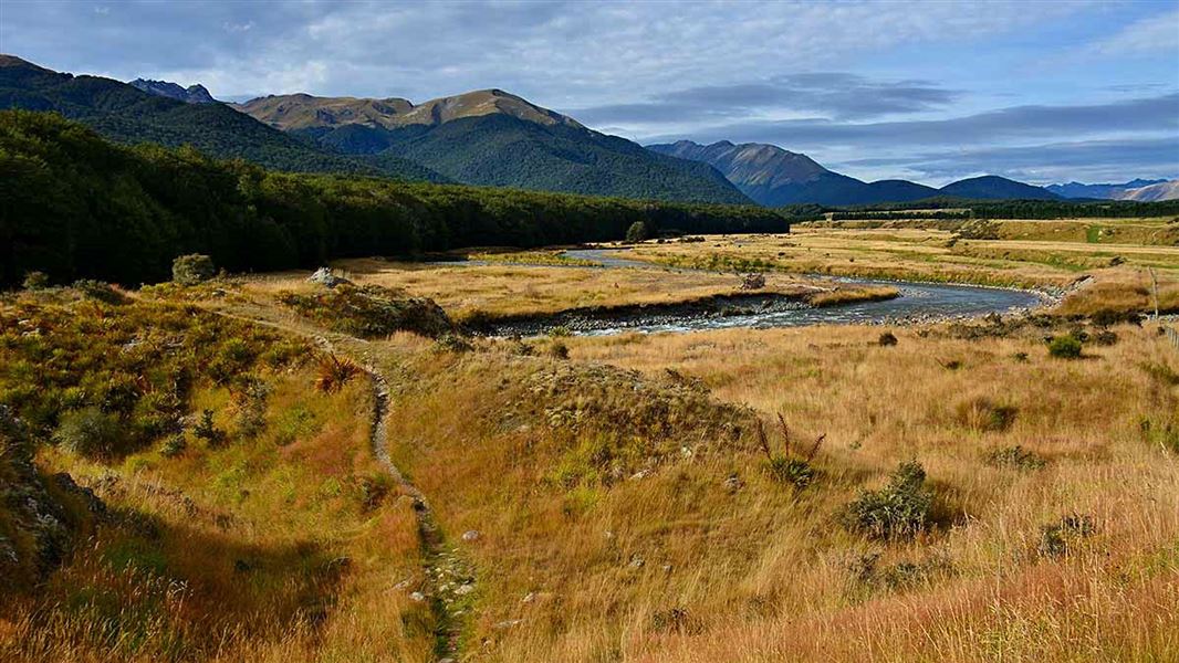
From the swingbridge 1.5 km from Hikuraki Station, a track follows the true right of the Mararoa River to a swingbridge at the outlet of South Mavora Lake. This is mainly flat walking with some muddy sections.
Swingbridge to Kiwi Burn Hut
Time: 1 hr 30 min
Turning left from the swingbridge 1.5 km from Hikuraki Station, a track follows down the true right of the Mararoa River to near the junction with the Kiwi Burn. It then follows up the Kiwi Burn for 15 minutes to a large clearing. The Kiwi Burn Hut, an ideal overnight stay for a family with younger children is sited near the bush edge.
Kiwi Burn Round Trip
Time: 3 hr 30 min
From the swingbridge 1.5 km from Hikuraki Station a marked route enters the forest and passes through several small clearings. A low ridge is crossed before descending into the Kiwi Burn. Heading up the Kiwi Burn an unmarked route leads to the Whitestone River; downstream a marked route leads to the Kiwi Burn Hut and returns via the Kiwi Burn and Mararoa River.
Kiwi Burn to Whitestone River
Time: 3 hr 30 min - 4 hr
The track into the Whitestone River valley follows on up the Kiwi Burn from the hut to a low bush saddle then descends to the Whitestone River. It then follows the river downstream on the true left side. This is pleasant walking with good camping on the open river flats. Use of portable stoves is encouraged; a permit from DOC Te Anau is required to use an open fire.
Whitestone River Valley - Upukerora River Valley (track is no longer maintained)
Time: 3 hr 30 min - 4 hr 30 min
Follow downstream for about 45 minutes from where the track enters from the Kiwi Burn. A sign indicates the land is private and you must stay within 20 metres of the river. After another 20 minutes track markers on the opposite side show the start of the 2 hour bush track through to the Upukerora River. This section of track can be very wet and muddy.
Once in the Upukerora Valley, the Army Hut (4 bunks) is sited about 1 hour up the valley, on the true left of the river.
Upukerora Valley to Milford Road (track is no longer maintained)
Time: 5 hr - 6 hr
Follow the Upukerora River down from the point where the track comes in from the Whitestone. Cross the Upukerora River and follow the 4WD track to near Dunton Swamp: a swampy clearing to the northwest. The edge of the swamp is followed then the track enters bush country, passing occasional clearings until Retford Stream is reached.
The track then crosses terraces and some small clearings. The open country you will see to the west is private land and permission must be obtained from Te Anau Downs Station to cross or hunt. Boyd Creek and the Milford Road will be reached in 3 hours from the Retford Stream.
Milford Road to Boyd Creek Tops (marked route)
Time: 2 hr 30 min - 3 hr 30 min
From the picnic area at Boyd Creek follow the vehicle track towards Boyd Creek Lodge. For permission contact Te Anau Downs Station. After 10 minutes the track enters the bush and is followed to the open tops. A large clearing marks the approx halfway point. From the bush edge you have a choice of routes; one is a crossing to the upper Upukerora.
Public access points into Snowdon Forest are from legal roads or riverside marginal strips - see brochure. Most marginal strips are suitable for walking access only.
Any other access into Snowdon Forest is across private/Landcorp land and permission must be obtained beforehand. View contact details for adjoining properties.
Walking access to Army Hut and the Upper Upukerora River area is possible either:
- On the public track from the Kiwi Burn swingbridge, via the Whitestone river
- By following the Upukerora riverbed upstream from the public access at the end of Ladies Mile Road (off of Kakapo Road)
- Please note that although the riverbed is open to public access, it is adjacent to both public and private land. There is no access or hunting on the adjacent private land without direct permission from the landowners.
Dogs are permitted for most of the year except during the lambing and calving period - September to November.
The tracks in Snowdon Forest are used infrequently; many are marked routes only.
Those to South Mavora Lake, Kiwi Burn Hut and the Whitestone River are checked and cleared once a year. The others are checked for markers yearly and cleared every three years. Some sectors can be very wet underfoot.
Trampers and hunters should be well equipped.
Stay safe in the outdoors
- Choose the right trip for you. Learn about the route and make sure you have the skills for it.
- Understand the weather. Check weather forecasts.
- Pack warm clothes and extra food. Check gear lists.
- Share your plans and take ways to get help. Leave your intentions with a trusted contact and take a distress beacon.
- Take care of yourself and each other.
Te Rua-o-te-moko/Fiordland National Park Visitor Centre
| Phone: | +64 3 249 7924 |
| Email: | fiordlandvc@doc.govt.nz |
| Address: | 1 Lakefront Drive Te Anau 9600 |
| Hours: | Visitor centre hours and services |
