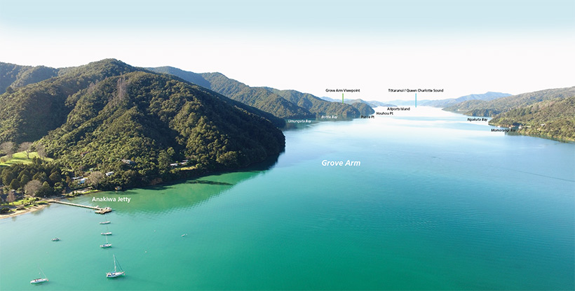
Well done! You have completed the Queen Charlotte Track. Relax on the grass near the Anakiwa jetty and bask in the glow of your achievement.
Anakiwa was once a significant Māori settlement occupied by a succession of tribal groups. The last residents from about 1830 were a section of the Ngāti Rahiri hapu of Te Atiawa. In 1853 Anakiwa was described by traveller and diarist John Salisbury as:
"... a populous place and picturesque in the extreme. Dark huts clustered together on rising ground, one more imposing than the rest being a church or chapel, the whole being enclosed by a stout palisade. Stiles were found at various corners by way of fortification against the Waikatos who might, perchance, pay an unexpected visit. ...There may have been a hundred Māoris there at that time, and a very sober, diligent folk did they appear to be. Quite a fleet of canoes lay there, ready for use. At the back of the Pā were extensive patches of cultivation, of potatoes, kumara and Indian corn."
Te Tau Ihu O Te Waka Volume 2 Hilary and John Mitchell
Just eight years later this scene was dramatically changed. Ngāti Rahiri had sold their Anakiwa holdings in 1859 and returned to Taranaki.
Craddock Beauchamp had purchased the land occupied by the old pā, built a house and was establishing a farm.
By 1880 timber milling was well underway in the area.
Herbert Beauchamp took over the freehold and leasehold land from his parents. His daughter Ethel, when married to John Hazelwood, established the Anakiwa Homestead Guesthouse.
It was a popular place for many decades before being purchased and on-sold to the Outward Bound Trust who today administer the renowned Outward Bound School.

Looking at the southwestern corner of Iwituaroa Scenic Reserve, seen at left. Some of the finest stands of native forest in Marlborough are contained within the Reserve. The track passes through it between Anakiwa and Grove Arm Viewpoint
Image: Marlborough District Council ©
View larger (JPG, 14K)