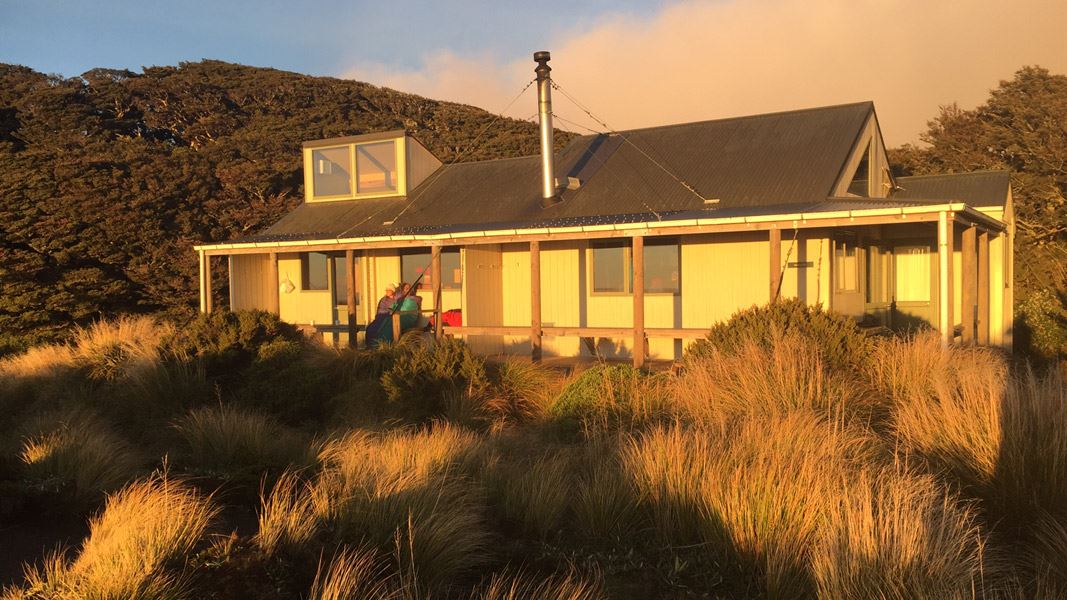
Located in the mid-eastern Ruahine Forest Park, Sunrise Hut is situated on the tops of the Ruahine Range. This hut is the most popular in the park. Sited in a tussock basin beside the bush edge at 1,280 m, the hut offers magnificent views across the Hawke’s Bay.
The original hut was constructed in 1983 by NZFS. It was upgraded in 2005. This is a large hut that is a popular recreational destination for day trips or weekend visits. The hut is heated by a woodburner. It is a popular walk for many family groups. The track is well formed, with a significant elevation gain from the carpark to hut of approximately 600 m. It takes 2-3 hours to walk from the carpark to Sunrise hut. In winter, there may be snow around the hut.
Facilities
- Tank water supply
- Large benched sleep areas catering for 20 persons
- Bench top with sinks
- Wood burner
- Broom/Shovel
- Long drop style toilet
- Two tables with bench seats
There are no cooking facilities in the hut. Although you may be able to use the woodburner as a cooking source, it is advisable to take your own cookers.
Note: Respect the rights of others to use the facilities and ensure all rubbish and foodstuffs are removed on departure.
Fees
Sunday to Friday
- Adult (18+ years): $25 per night
- Child/youth (5-17 years): $12.50 per night
- Infant (0-4 years): free
Saturday
- Adult (18+ years): $30 per night
- Child/youth (5–17 years): $15 per night
- Infant: (0-4 years): free
Backcountry Hut Passes can be used at this hut.
About hut tickets and passes | Retailers that sell hut tickets and passes
Bookings
Bookings for the 2026/27 season open at 12 noon on Tuesday 12 May 2026.
- If no availability shows online for your dates, the hut is fully booked.
- No spaces are kept for visitors arriving without a booking.
- Phone and in‑person bookings made at a visitor centre incur a $10 service fee.
- Same‑day bookings are available online until 8 pm if spaces remain.
Bookings are required all year.
Your hut booking is for any bunk bed, not for a specific bunk bed – select your bunk bed on arrival. There is no camping at this hut.
The North Block Road end is the most popular starting point for visitors to the Eastern Ruahine.
North Block Road is approximately 100 km from Napier. Follow State Highway 50 for 66 km and turn right into Wakarara Road. After 20 km, turn left into North Block Road. The start of Sunrise Tracks starts at the road end.
The last 4 km of this road is through private farmland. Dogs are not permitted. No loaded firearms or hunting on farmland. Keep to the formed road, don’t disturb stock and leave gates as you found them.
Tracks to this hut
-
Duration: 2-3 hr one way Difficulty: Easy
Location
NZTopo50 map sheet: BK36
Grid/NZTM2000 coordinates: E1871197, N5590932
Weather forecast
Nature's in trouble
Thousands of New Zealand’s native species are heading towards extinction. Once they’re gone, they’re gone for good. Nature needs your help.
Hut and campsite bookings
| Phone: | +64 7 867 9080 |
| Email: | kauaerangavc@doc.govt.nz |
DOC Customer Service Centre
| Phone: | 0800 275 362 |
| Email: | manawatu@doc.govt.nz |
| Address: | Te Papaioea / Palmerston North Office |