
Dog access
No dogs. Other pets on conservation land rules.
Tukino Access Road is located approximately 20 km north of Waiouru. It is a rough gravel road and suitable for 4WDs only.
Tukino Access Road is not a recreational 4WD track
Drivers should expect oncoming traffic at any time and vehicles must never leave the road. It is an offence to take any type of vehicle (4WD, motorcycle or mountain bike) off the formed road.
This area is identified as having unexploded ordnances (military explosives) from previous land use as a military training zone for the New Zealand Defence Force (NZDF). There is clear signage at site. There is a serious risk of injury or death if you ignore warnings.
During winter, it is recommended that you carry chains and know how to put them on.
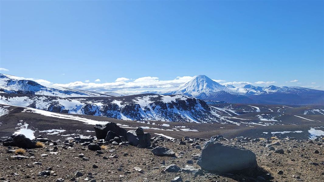
This is a challenging alpine area
Tukino is a challenging mountain environment. There are no formed or poled walking tracks or administered climbing areas. Any activities or trips planned here are only suitable for highly experienced, well-equipped hikers and climbers.
The area is very remote. You are a long way from help if you get into trouble.
Hazards in this area include:
- Extreme, changeable weather with extremely high winds, sub-zero temperatures, and low visibility.
- Ice and snow.
- Avalanche.
- Slippery, rocky terrain with steep drop offs.
- Volcanic risk.
- Rockfall.
Be ready for extreme weather at any time of year
The weather can change suddenly – be prepared for all conditions. Adverse weather conditions are common, including extremely high winds, snow, ice and freezing temperatures. Snow can turn to ice underfoot. Plan ahead, and make sure you are prepared to walk out in different conditions than the walk in.
Carry warm, waterproof clothing and survival equipment at all times of year.
Check the Tongariro National Park weather forecast – NIWA website
There are more hazards from May to November
In the winter months (May to November) additional hazards are present. You need to:
- know where avalanches are a risk and be able to rescue someone if an avalanche occurs. Read about avalanche risk in Tongariro National Park
- have the equipment and skills to prevent a slide on icy terrain
- have the clothing for sub-zero temperatures and be able to survive if the weather gets worse
- have the knowledge and equipment to navigate in low visibility conditions
- check the New Zealand Avalanche Advisory for Tongariro National Park.
Climbing on Mt Ruapehu
The mountains are sacred to local iwi (Māori tribal groups). Respectfully they ask visitors not to summit the mountains in the Tongariro National Park.
DOC discourages hiking or climbing into the summit hazard zones. See Volcanic risk in Tongariro National Park.
Anyone attempting to climb Mt Ruapehu during the summer months must have mountaineering, alpine, backcountry, navigation skills and experience. Ice axes and crampons will be required past the snow line.
There is no marked track to the summit. DOC do not administer any alpine climbing tracks on Mt Ruapehu.
There is avalanche terrain on all routes to the summit. Approaches from most directions and onto the summit of Ruapehu involve travel through challenging and complex terrain. Read more about avalanche terrain in Tongariro National Park.
A good alternate to summiting Mt Ruapehu is the Skyline Walk located within the Whakapapa Ski Area. This track has marker poles. See Whakapapa Ski Area's self-guided and marked short walks.
There are local concessionaires who offer guided trips on all the mountains.
Whangaehu River valley is a known lahar path
Move through this area quickly and do not stop in this area. This section of the Round the Mountain Track that travels through this valley is clearly marked with signage.
Vehicles must stay on the formed road at all times
The access road to Tukino Ski Area is only suitable for 4WDs. Vehicles must stay on the formed road at all times. Endangered plants and nesting birds are in this area. There is also a risk of unexploded ordance (military explosives) from when this area was used as part of the military training camp.
No freedom camping
Freedom camping is not allowed in this area.
No dogs
This area is part of the world heritage Tongariro National Park. No dogs are allowed, not even in vehicles.