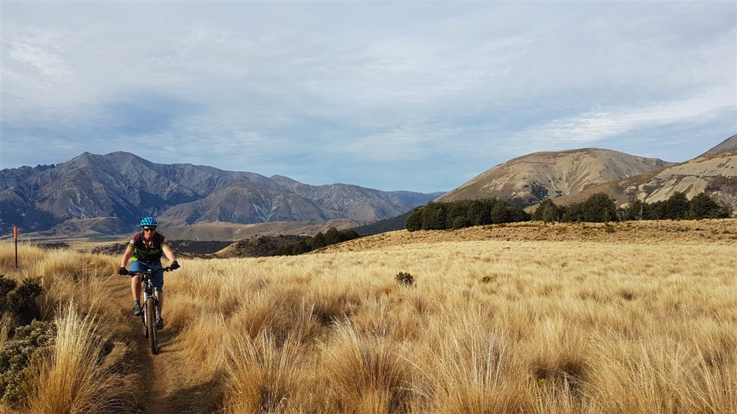
It is a place of extremes with the sheltered valleys and lower slopes clothed almost entirely in mountain beech, whilst forces of erosion have crumbled the mountain tops to create Craigieburn’s characteristic rock screes.
Craigieburn Forest Park is in Canterbury, beside highway 73 between Christchurch and the West Coast.
About 110 km from Christchurch on Highway 73 towards Arthur’s Pass, is a signposted side-road to the Craigieburn Picnic Area on the Broken River ski field road. Access to Craigieburn Valley is another 1 km further along the highway. Both ski field roads have locked gates further up valley during the summer.
Weather
The summer climate of Craigieburn is usually hot and dry, but in winter snowfalls are common.
In all seasons the weather is changeable, and special care should be taken on routes above the bush-line.
Weather forecasts are available from DOC Visitor Centre at Arthur’s Pass.
Mount Cheeseman weather forecast – NIWA website
Fires
No fires are permitted within the Craigieburn Forest Park, except in designated fireplaces. Check with DOC concerning restricted or total fire bans.
Pamphlets and maps
- Craigieburn Forest Park: Day Walks
- Cass Saddle – Lagoon Saddle Route Guide 12
- NZTopo50 maps BV20, BV21, BW20, BW21
Further information
There is an emergency phone at Castle Hill village, about 10 km on the main highway towards Christchurch.
For walking advice, maps, weather information and informative displays contact the DOC Visitor Centre at Arthur’s Pass.
Wasp populations reach high numbers from January to March – wear light coloured clothing and carry antihistamine cream/tablets as a precaution.
Thieves targeting cars at Arthur's Pass
There have been reports of cars being broken into and disabled at track ends.
- Don't leave valuables in your vehicle.
- Consider using more public parking sites – ask at the Arthur's Pass Visitor Centre for alternative options.
- Report any suspicious activity to police on +64 3 363 7400.
Vegetation
The forest is mostly mountain beech/ tawhairauriki, which has easy identifiable small leaves that end in a point, like a ‘peak’. It is thought that millions of years ago much of the forest that covered the ancient landmass of Gondwanaland looked like the forest of Craigieburn. Fossils of beech trees have been found in Antarctica and descendants survive in Chile, Australia and New Guinea. Above the bush-line there is alpine scrub and tussock grasslands. Scree plants are sparse but well suited to an incredibly harsh environment of bright light, temperature extremes, moving shingle and drying winds.
Wildlife
During summer you might find skinks (a type of ‘snake-like’ lizard) on the mountainside, plus the occasional spider, scree weta, armour plated grasshopper, black scree butterfly, kea and the scarce New Zealand falcon/kārearea.
Kea
Visitors to the park might see these naturally inquisitive birds. They are the world’s only alpine parrot.
Please do not feed kea, but let them look for their natural foods (berries, roots, shoots and insect larvae). Feeding attracts kea to areas of human use, such as carparks, picnic and camping areas, where they may damage cars, tents and personal gear.
Remember, kea are fully protected.
Pest plants and animals
Old experimental pine tree plots are a feature on the lower slopes around Craigieburn. Pine seedlings – wildings – from the now abandoned trials, are spreading through Craigieburn Forest Park. Wilding pines and some of the trial plots are slowly being removed.
Arthur's Pass National Park Visitor Centre
| Phone: | +64 3 318 9211 |
| Email: | arthurspassvc@doc.govt.nz |
| Address: | 104 West Coast Road Arthur's Pass 7654 |
| Hours: | Visitor centre hours and services |
