12.3 km to Carrington Hut one way
SH73 – Carrington Hut
The track to Carrington Hut has been cut off by the Waimakariri River 2 km upstream from Anti Crow Hut. It is still marked on the topographic maps but is now impassable. You will need to cross the Waimakariri River at least two times before rejoining the track.
This river crossing is always difficult. Be prepared to turn back.
Via O’Malley's Track
Leave SH73 on the true right of the Waimakariri River, immediately south of the road bridge over the river. A well-marked track (known as O’Malley's Track) passes above bluffs to Turkey Flat by Jordan Stream. From here, follow pole markers across the flats, staying high to avoid the thorny native matagouri shrubs lower down.
Once past the flats, follow the bush edge to Anti Crow Hut. A 400 m section of track leading to the hut from the end of the flats can be used when the river has pushed into the bluff here.
Anti Crow Hut to Carrington Hut
Note that the Jordan Stream and Anti Crow River can be dangerous to cross after very heavy rain.
Continue along the track behind Anti Crow Hut through beech forest. The track crosses a small stream near the foundations of the original Anti Crow Hut. When you reach the Anti Crow River, look for a safe place to cross. This can be an extremely dangerous crossing if the river is running high.
The hard rocky knolls you cross are called roche moutonnée (or sheepback). Thousands of years ago, when glaciers covered this area, the moving ice sculpted these outcrops of hard rock.
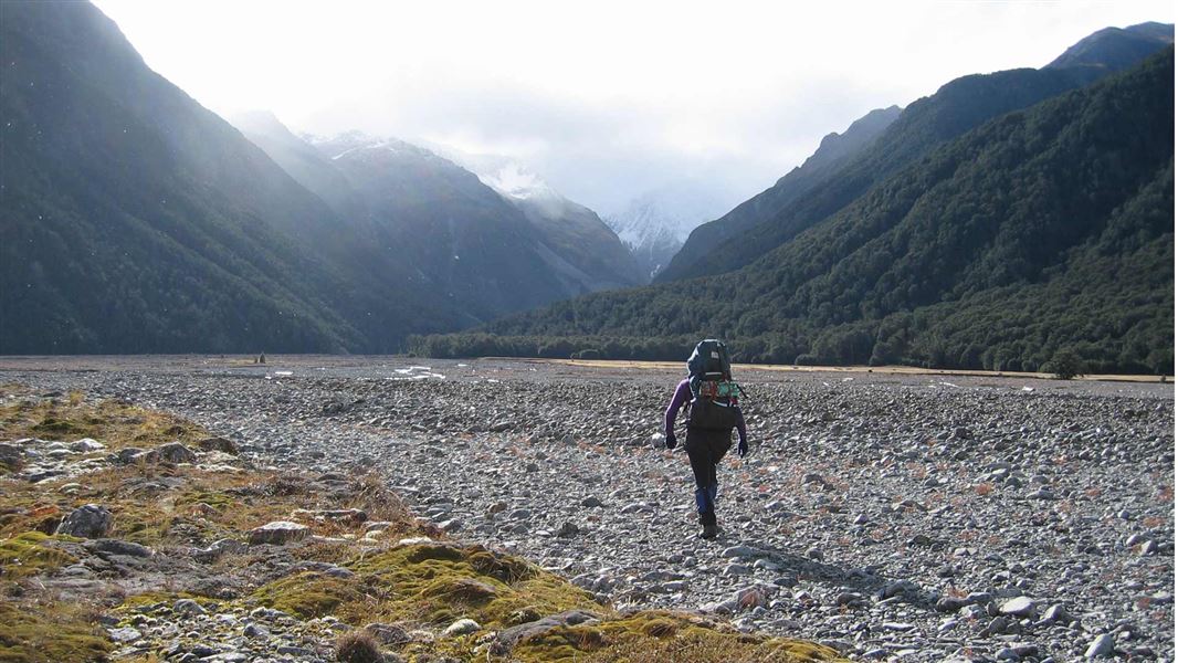
The track then drops down to the Waimakariri riverbed. The Waimakariri River has changed course here, cutting off access to both ends of the next track section. Find a safe place to cross the river and do not attempt if the water is high. Continue following the true left of the river upstream for about 900 m, looking for another safe crossing to rejoin the track in the river flats before Greenlaw Creek, past the bluffs. Follow the track, crossing Greenlaw Creek and Harper Creek – both are dangerous crossings when they are high. The track beyond Harper Creek is well marked.
As you get closer to Carrington Hut, keep an eye out for the serrated top of Carrington Peak. Just before the White River joins the Waimakariri River, a short section of marked track leads to Carrington Hut, marked by a large rock cairn and orange marker.
Via riverbed – not marked
A 2 km long gravel road leads to the Waimakariri riverbed from the western side of Klondyke Corner. The quickest way to Carrington Hut is to head straight up the Waimakariri valley from this point, cutting corners and crossing the river where necessary. Aim for the lower edges of Turkey Flat. From there, either continue up the riverbed or pick up the track behind Anti Crow Hut or at Anti Crow River.
If you prefer to continue up the riverbed, head towards the high embankment of the Anti Crow River fan, climbing through a rubble-filled gully to its top. Head north into more open ground, and then west, crossing the Anti Crow River before dropping down another steep embankment to the Waimakariri River.
Cross to the true left of the Waimakariri River and continue upstream for 1.4 km towards the two jutting headlands. Re-cross the Waiamakariri River back to its true right and continue towards Greenlaw Creek, picking up the poled track in the river flats beyond. Follow the marked track to Carrington Hut
Day trips from Carrington Hut
Note: The Clough Cableway beyond Carrington Hut has been removed.
White River (Barker Hut)
Time: 8–10 hr return
A trip up the White River is an interesting but challenging day walk from Carrington Hut. Barker Hut (10 bunks) is in an alpine basin high up in the head of the White valley. It has no heating and is owned and managed by the Canterbury Mountaineering Club – for fees and payment see Barker Memorial Hut.
It takes 4–5 hr to walk from Carrington Hut to Barker Hut. The route along the river constantly changes because of active rock slides; the first 1.5 km of the track marked on some maps beyond Kilmarnock Falls has been destroyed. A cairned route leaves the river at a large cubic rock to rejoin the remaining vague track high above the river. The route eventually drops back down to the White River before the Cahill Glacier stream, following numerous rock cairns and climbing onto old glacial moraines.
Waimakariri Falls Hut
The route to Waimakriri Falls Hut is covered by the Waimakariri Falls Hut to Rolleston River route.
The trip starts at SH73 on the true right of the Waimakariri River, just south of the Bealey road bridge (about 10 km east of Arthur's Pass village). The route follows O'Malley's Track for the first stage of the trip.
Experience required
Suitable for trampers with high level backcountry skills and experience. River knowledge and crossing skills essential.
Required map
NZTopo50: Otira BV20
Hazards and safety
Hazards include flooded rivers, and avalanche risk on day trips above Carrington Hut.
Note: True left and true right refer to the side of the valley or river when facing and looking downstream.
See Tramping in Arthur's Pass National Park (PDF, 762K), and New Zealand's Land Safety Code.
Before setting out, check the latest track conditions and avalanche advisory with the Arthur's Pass Visitor Centre.
Stay safe when crossing rivers
If you plan to cross unbridged rivers, know how to cross safely and be prepared for if you cannot cross.
Do not cross if the river is flooded, you cannot find safe entry and exit points or are unsure it’s safe. Turn back or wait for the river to drop. If in doubt, stay out.
NIWA river flow forecasts: View a video of national followed by regional river flows
There may be avalanche danger
Avalanches usually occur from May to November in Arthur’s Pass National Park. There can also be avalanches outside this period, if there is still snow coverage.
Check the avalanche terrain in this area.
If you are going into avalanche terrain, always:
- Have the relevant avalanche skills and training.
- Check the ATES rating and New Zealand Avalanche Advisory before you go.
- Go with a buddy. Both of you should carry and know how to use an avalanche transceiver, a snow shovel and a probe.
Stay safe in the outdoors
- Choose the right trip for you. Learn about the route and make sure you have the skills for it.
- Understand the weather. Check weather forecasts.
- Pack warm clothes and extra food. Check gear lists.
- Share your plans and take ways to get help. Leave your intentions with a trusted contact and take a distress beacon.
- Take care of yourself and each other.
Arthur's Pass National Park Visitor Centre
| Phone: | +64 3 318 9211 |
| Email: | arthurspassvc@doc.govt.nz |
| Address: | 104 West Coast Road Arthur's Pass 7654 |
| Hours: | Visitor centre hours and services |