There are two tools to help you assess avalanche danger:
- New Zealand Avalanche Advisory (NZAA) - based on the stability of snow and changes with the weather.
- Avalanche Terrain Exposure scale system (ATES) - based on terrain and does not change with the weather.
Anytime that snow and steep slopes are combined there is potential for an avalanche.
New Zealand Avalanche Advisory
The best way to understand the avalanche danger in Arthur's Pass National Park is to check the New Zealand Avalanche Advisory (NZAA).
The NZAA provides daily assessments of avalanche likelihood at different elevation bands and aspects, primary and secondary dangers, along with recent avalanche activity, current snowpack conditions and mountain weather. The NZAA is also available at DOC visitor centres.
The NZAA is provided by the Mountain Safety Council (MSC) as an advisory only. We recommend you also check the Arthur's Pass National Park weather forecast as part of your trip planning.
Avalanche Terrain Exposure Scale
The Avalanche Terrain Exposure Scale (ATES) rates avalanche terrain based on the angle and shape of the ground or the number of established avalanche paths.
How ATES applies in Arthur's Pass National Park
Arthur's Pass National Park covers 119,000 hectares of mountainous terrain and avalanche conditions can vary throughout.
Tracks to summits and unforested valleys
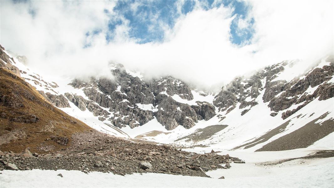
The majority of the avalanche threat is on tracks that lead onto mountain summits, or into the deep unforested valleys that venture into the heart of the Southern Alps. Avalanche run-out zones in these valley floors are usually self-evident, with little vegetation and clearings in these zones.
These avalanches can run multiple times on the same path during the season and are very fast-moving, leaving little chance of avoidance. It is common to receive over 5–10 metres of snow in the high alpine parts of the park during the winter and spring months.
Along forested valleys
The majority of Arthur's Pass National Park tracks wander along forested valleys that do not hold permanent winter snow.
However, due to the surrounding steep-sided mountains and wet snow conditions, avalanches still have potential to reach valley floors in these areas in the rare big snow years and are extremely destructive.
Some of these run-out zones have revegetated over time, and may not be obvious to those passing through them. Some huts and structures in the park are in these potential run-out zones.
Temple Basin Ski Area
Temple Basin ski area can be operating between late June and late October.
Avalanche control work on the ski area is done to make the ski area safe while they are open for skiing. Explosives may be in use for avalanche control work. Outside of normal open hours, and when the ski area or parts of it are closed, there may be avalanche hazards in the closed terrain. During those times you need to take the ATES classification and avalanche danger level into account.
Check in with ski patrol if you wish to access the area during operating hours and obey all ski area closures.
ATES ratings in Arthur's Pass National Park
You need to have the right level of experience to safely travel simple, challenging or complex terrain. To find out what experience is needed for each, check our avalanche safety page.
Simple
- Andrews Valley to Casey Hut
- Avalanche Peak (to bushline)
- Bealey bridge to Carrington Hut
- Bealey Lagoon block
- Bealey Valley Track
- Bealey Spur Track
- Binser Saddle Track
- Bridal Veil Track
- Casey Hut to Poulter Hut
- Cons Track (to bush line)
- Devils Punchbowl Track
- Dobson Nature Walk
- Hawdon Hut Track
- Mt Aicken Track (to bush line)
- Mt Bealey Track (to bush line)
- Poulter River Track
- Temple Basin Track
- Waimakariri riverbed
- Woolshed Hill Track (to bush line)
Challenging
- Andrews Stream near Hallelujah Flat
- Crow Hut Valley Track to Waimakariri River
- Edwards Hut Track
- Mingha Biv to Upper Deception Hut
- Mingha / Deception Route
- Ōtira Valley Track to bridge
- Poulter Hut to Lake Minchin
- Sudden Valley Biv (to biv only)
Complex
- All of Eastern Arthur's Pass National Park
- Avalanche Peak (above bushline)
- Avalanche Peak to Crow hut
- Carrington Hut to Waimakariri Falls Hut
- Carrington Hut to Barker Hut via river
- Carrington Hut to Browning Pass
- Coral Track
- Edwards to Hawdon Hut via Tarn Col/Walker Pass
- Minchin Pass Route
- Ōtira Valley Track (beyond bridge)
- Sudden Valley Biv (beyond biv)
- Scotts Track (above bushline)
