
Map of areas under investigation - Kauri National Park proposal
Introduction
View a map of areas under investigation for the Kauri National Park proposal and a vegetation map of Waipoua Forest.View a map of areas under investigation for the Kauri National Park proposal and a vegetation map of Waipoua Forest.
Map of areas under investigation 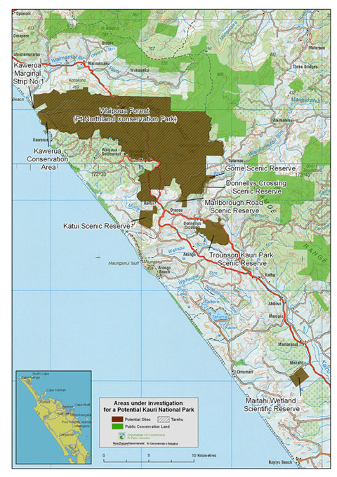
View a larger printable version (PDF, 2,809K)
Vegetation map of Waipoua Forest
View a vegetation map of Waipoua Forest showing the locations and boundary types of native vegetation present. The map includes a vegetation legend and symbols, and a glossary of plant names.
Vegetation map of Waipoua Forest (PDF, 2,926K)
Note: this is a large file that will take time to download. The map is not suitable for printing due to its detail.
Reference: Burns, B.R. and Leathwick, J.R. 1992: Vegetation map of the Waipoua Forest Sanctuary and environs, Northland, New Zealand. Scale 1:25 000. FRI Bulletin No. 143. Ministry of Forestry, Wellington.