Where DOC manages volcanic risk
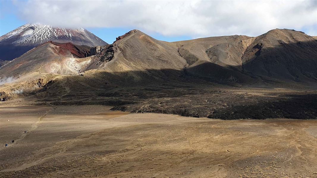
There are three visitor-accessible volcanoes on public conservation land that have active or recently active volcanic vents. All three are in Tongariro National Park:
- Mount Ngāuruhoe – last erupted in 1977
- Mount Ruapehu – last erupted in 2007
- Mount Tongariro – last erupted in 2012
The only other volcano with a recently active vent on land managed by DOC is Raoul Island, which is not accessible to the public. This volcano last erupted in 2006.
How we manage volcanic risk
DOC manages volcanic risk through its volcanic risk management guidelines.
Using these guidelines, DOC manages proximity to potential eruption sources (hazard exposure) as volcanic unrest (risk) increases. Our management actions are mostly triggered by Volcanic Alert Level (VAL) changes. We will also make decisions on access based on other inputs from GNS Science and risk assessments.
The Volcanic risk management at Mt Ruapehu map (PDF, 21,254K) shows how visitor proximity to the Crater Lake vent is managed as volcanic unrest (risk) increases.
Volcanoes are incredible and volatile forces of nature. It’s important to recognise that despite DOC having a robust volcanic risk management system in place, people's safety can never be guaranteed when close to an active volcanic vent.
A significant part of DOC's risk management work is notifying the public of the risk so people can make decisions on the level of risk they're willing to accept.
What to do in the event of an eruption
New Zealand Volcanic Alert Level (VALs)
VALs define the current status of New Zealand's volcanoes. There are six levels, ranging from no volcanic unrest, through two levels of volcanic unrest, to three levels of volcanic eruption.
| VAL | Volcanic activity | Most likely hazards | |
|---|---|---|---|
| Eruption | 5 | Major volcanic eruption | Eruption hazards on and beyond volcano* |
| Eruption | 4 | Moderate volcanic eruption | Eruption hazards on and near volcano* |
| Eruption | 3 | Minor volcanic eruption | Eruption hazards near vent* |
| Unrest | 2 | Moderate to heightened volcanic unrest | Volcanic unrest hazards, potential for eruption hazards |
| Unrest | 1 | Minor volcanic unrest | Volcanic unrest hazards |
| 0 | No volcanic unrest | Volcanic environment hazards | |
VALs do not forecast future activity. They provide an assessment of a volcano’s level of unrest at the time the alert level is applied and communicated.
Changes after the 2012 Te Maari eruptions
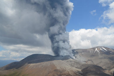
Te Maari erupting on 21 November 2012 – the lesson was the need to be decisive
Image: Craig Miller, GNS Science ©
The Te Maari eruptions in 2012 reinforced the need for decisive action when volcanic unrest increases on Mt Tongariro.
When volcanic unrest reaches VAL 1 or 2, DOC works with Earth Sciences New Zealand to assess where the unrest is occurring and how confidently scientists can identify its source.
If experts can confidently identify a single source of unrest at either Ngāuruhoe or Te Maari, DOC may close only the area within 3 km of that vent. This allows parts of the Tongariro Alpine Crossing and Tongariro Northern Circuit to remain open where it is considered safe to do so.
If the source of unrest is uncertain, if activity is occurring at more than one vent, or if the unrest is centred on Red Crater, DOC takes a more precautionary approach and closes the entire Tongariro Alpine Crossing and most of the Tongariro Northern Circuit.
Decisions about track closures and reopening are informed by monitoring data, risk assessments, advice from Earth Sciences New Zealand and other volcanic hazard experts, and consideration of cultural management measures such as rāhui.
Changes since the 2019 Whakaari eruption
The management of volcanic risk has not materially changed since the Whakaari eruption.
DOC has well established systems to manage risk that have improved over decades, learning from the multitude of eruptions that have occurred in Tongariro National Park.
Our documentation is always evolving, and our practices are subject to change as improvements are identified, and progress is made in the fields of earth science and risk management.
Our current approach incorporates the consideration of eruption probability but recognises that the most robust mechanism we have to trigger management action is Volcanic Alert Levels.